Our world is filled with amazing places to see. From strange to strangest, and weird to weirdest, the planet earth has a lot in store to amaze us.
From a pink lake that displays its glory when looked upon from above, to an island ruled by cats, these are 22 of the most amazing places you will probably ever see.
1. The Giant’s Causeway, Ireland
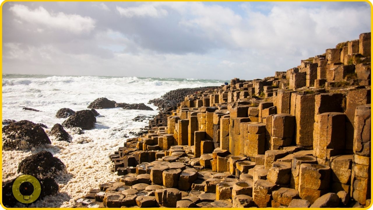
The Giant’s Causeway is the result of an ancient volcanic eruption. Forty thousand years ago, this volcanic activity created the hexagonal columns of basalt rock that make up the Giant’s Causeway in County Antrim, Northern Ireland. The site is composed of some 40,000 interlocking basalt columns.
The causeway has become a major tourist attraction in the country. The columns are over 60-feet high and continue out into the sea for a distance of a further 0.5 miles.
2. The Wave, Arizona
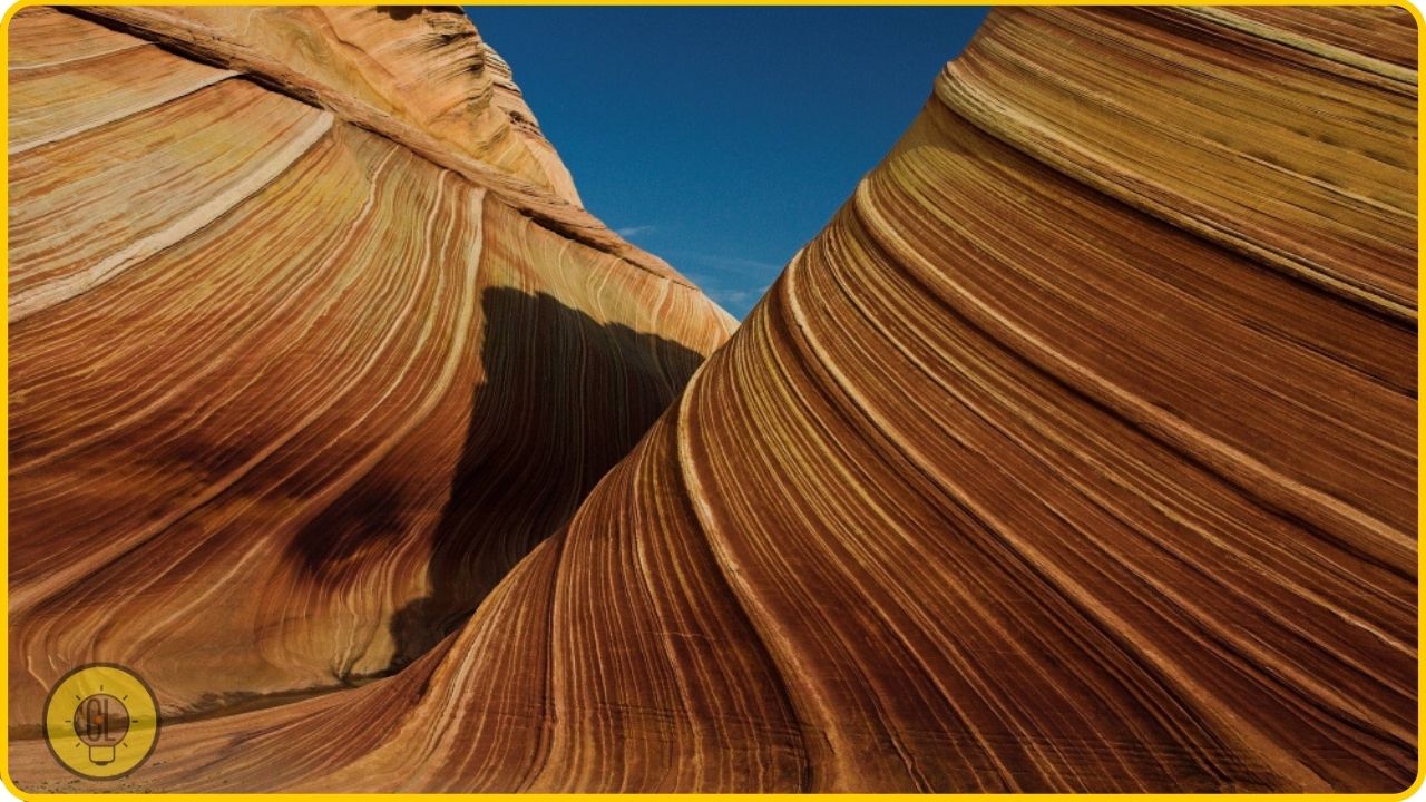
The Wave is an unusual geological formation near the Arizona-Utah border. It is a sandstone rock formation in Arizona’s Paria Canyon-Vermilion Cliffs Wilderness. The term “wave” in this context is an allusion to the way in which the rock formations appear to break and move like waves as the wind blows them. The rock formation is a part of a larger formation that includes a formation called the Totem Pole.
The Wave was formed from sandstone that was deposited in the Paria River bed some 350 million years ago. The particular wave-like shape was formed by the wind blowing the sandstone around.
3. Pamukkale, Turkey
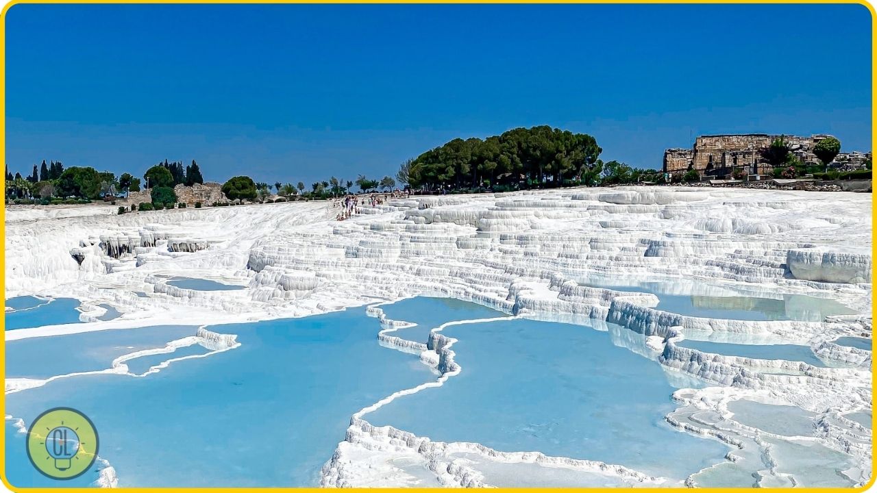
Pamukkale is a natural site in Turkey noted for its carbonate deposits. In English, this means that it is a site where calcium carbonate is deposited. The site has a number of terraces where these calcium carbonate deposits can be found. It is located in the Denizli province of Turkey.
The terraces are the result of hot water springs which flow down from the nearby mountains and deposit calcium carbonate minerals on the terraces. Over the centuries, the terraces have become increasingly popular with tourists. These days, Pamukkale is visited by some 2 million tourists each year.
4. The Door to Hell, Turkmenistan
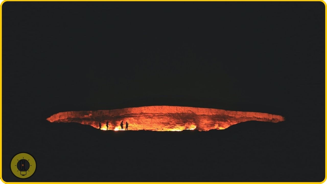
The Door to Hell is a burning natural gas field in Derweze, Turkmenistan. In the middle of the Karakum Desert, the ground is littered with a number of large craters, all of which are still burning. The craters are the result of Soviet drilling operations in 1971. The ground in the area has been burning ever since.
There is some dispute as to whether the field can ever be extinguished. For this reason, the site is now a tourist attraction, drawing in some 1,000 visitors per year.
5. The Tianzi Mountains, China
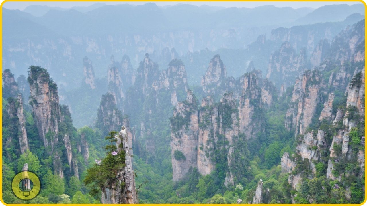
The Tianzi Mountains are a group of mountains located in China’s Hunan Province. The mountains are home to an unusual geological phenomenon. At one point, the mountains appear to erupt with a mass of multi-colored earth and stone. It looks like a large amount of mud is flowing down the mountains.
This strange sight is actually caused by the process of erosion. The peaks of the mountains have a series of fissures. In the cracks, gypsum (a mineral made of calcium sulfate) has collected. As the temperature changes, the gypsum expands. This causes the fissures in the peaks of the mountains to widen. Eventually, the gypsum is pushed out in a sudden burst.
6. The Nasca Lines, Peru
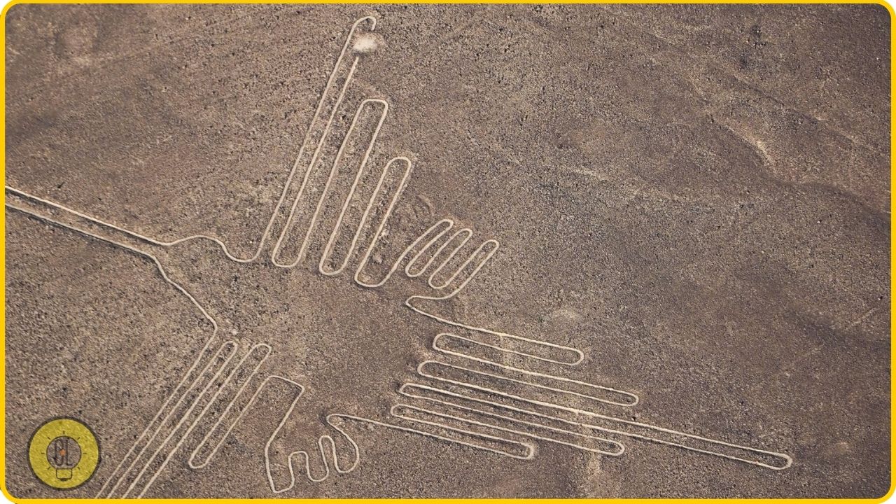
The Nasca Lines are a series of straight lines, geometric shapes, and pictures that have been etched into the ground in the Peruvian desert. The lines cover a region of some 1,200 square kilometers.
The Nasca lines are not easy to see from the ground, which is why it is believed that they were not made by humans. Scientists believe that the lines were made by members of the Paracas culture.
7. Fly Geyser, Nevada
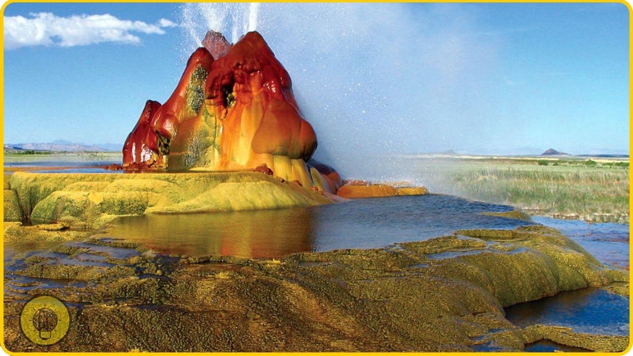
Fly Ranch Geyser is a geyser located in Nevada. It is also known as Fly Geyser or Fly Ranch Fountain. The geyser was accidentally discovered in 1964. At the time, a geothermal energy company was working on the geyser field in the area. As they drilled, water and steam started to shoot out of the ground. The geyser then began to overflow, and it became known to the company as Fly Geyser.
The geyser is located on private property, so it’s not possible to visit. However, it is possible to watch it from the road. It is located on the edge of the Walker Lake.
8. Magnetic Hill, Canada
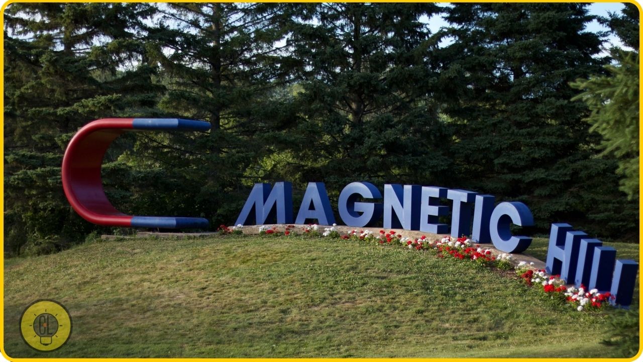
Magnetic Hill is a gravity hill situated in Canada, near the town of Moncton. The gravity hill is located on the Magnetic Hill Road. It is a popular tourist attraction.
The Hill is actually a man-made phenomenon. The locals created it to attract tourists. The road is on a slight incline. It also has a slight curve, and it’s surrounded by tall trees.
When you reach the bottom of the hill, you experience a strong feeling of going uphill despite going in a straight line. The phenomenon is caused by the road itself. The air above the road is a bit denser than the air at the bottom of the hill, which means that a car will feel as though it has less traction at the bottom of the hill.
9. Socotra Island, Yemen
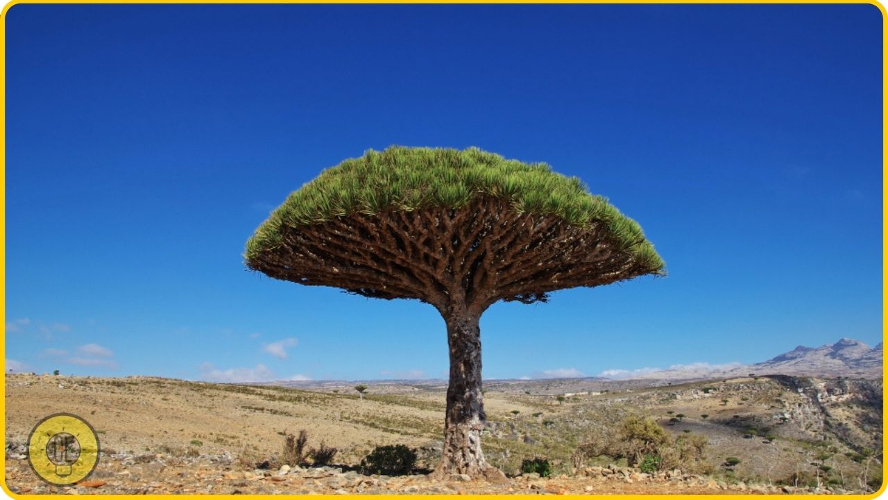
Socotra is a small island located in the Indian Ocean. The island is located some 480 kilometers (300 miles) off the coast of Yemen. Socotra is known for its unique plant life. Of the approximately 800 plant species on Socotra, more than 70 percent are found nowhere else in the world. Many of the plant species of Socotra are rare and endangered.
10. Mount Roraima, Venezuela
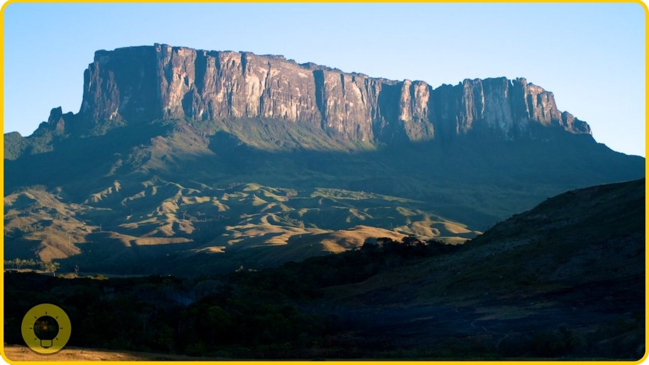
Mount Roraima is a mountain located in the Canaima National Park of Venezuela. The mountain is considered to be the tallest of the Pakaraima chain of tepuis, which is a type of mesa, or flat-topped mountain. Mount Roraima is of particular interest to geologists and biologists.
The mountain is of particular interest to geologists because it is geologically ‘old’ in a sense. It is made of sandstone and quartzite, which are kinds of rock that are rarely found these days. It is of particular interest to biologists because the flora and fauna of the mountain are unlike that found on any other mountain.
11. Crooked Forest, Poland
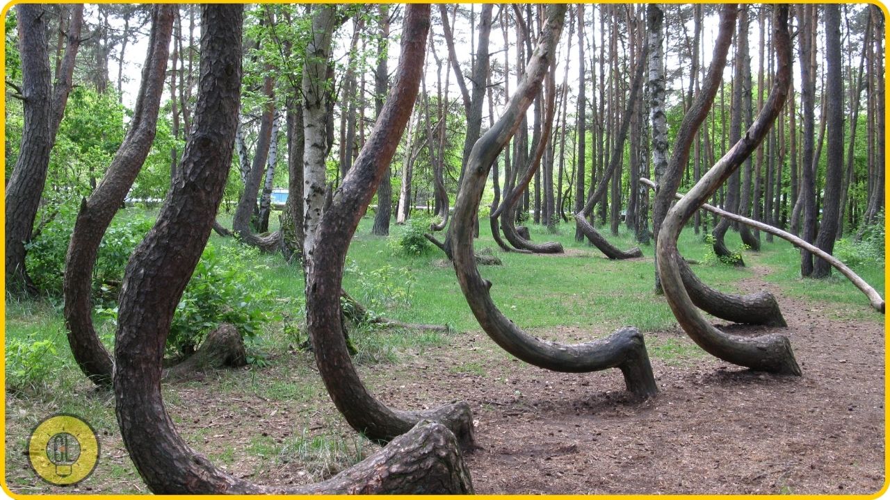
The crooked forest is a grove of trees located near the village of Jelenia Gora in Poland. The trees in the grove are not actually crooked, but they all lean at an angle of about 10 degrees, making the grove look like it is populated with crooked trees.
The grove of trees is the result of a series of human errors. Back in 1940, the German army was using the area around the grove as a training ground, and it was decided to plant trees to make the area look more attractive.
The trees were planted in rows, all pointing in the same direction. The next year, the grove was hit by a storm, which caused the trees to bend in the direction of the wind. So, the trees continued to bend, and the grove looks like it does today.
12. Plain of Jars, Laos
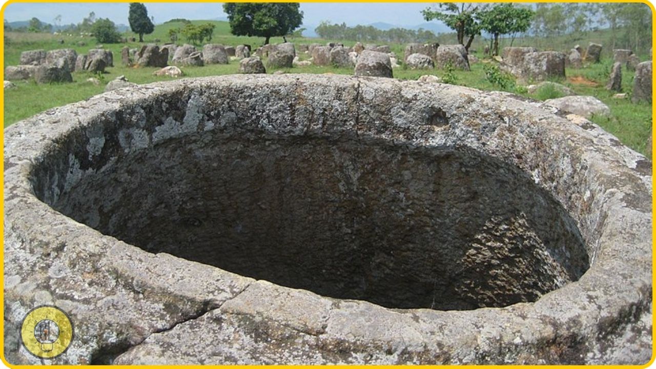
The Plain of Jars is a megalithic archaeological site in Laos. The site is located in the Xieng Khouang plateau. The area is dotted with thousands of stone jars, of a variety of sizes. The jars are thought to date from the Iron Age.
The jars are thought to have been used for burial or are perhaps the remnants of ancient burial sites. However, the real purpose of the jars is not known for certain. The Plain of Jars was added to the UNESCO World Heritage Tentative List in 1993, in the Cultural category.
13.Gunkanjima, Japan
Gunkanjima is a small island, off the coast of Nagasaki, Japan. The island is uninhabited, but it is easily accessible. It is possible, for example, to take a day trip to Gunkanjima. The island has a population of over 1,000 people, but it is located in a restricted zone.
The island has been uninhabited since the 1980s. It is believed to have been inhabited since the 1890s. In the past, the island was the site of a coal mining facility. The island was the site of a number of coal gas explosions in the 1970s, which caused a number of deaths. The island is a historical relic of Japan’s industrial past.
14. Trolltunga, Norway
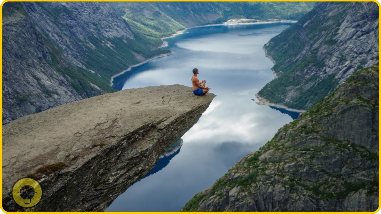
Trolltunga means “The Troll’s tongue” in Norwegian. It refers to a piece of rock jutting horizontally out of a mountain about 700 meters (2,300 ft) above the north side of the lake Ringedalsvatnet in the municipality of Odda in Hordaland county, Norway.
This rock formation, which is known for its beauty, is located about one kilometer from the Skjeggedal parking lot. The hike from the parking lot to the rock is about 10–15 minutes. The hike to the peak is a strenuous hike, and the trail is steep and goes up about 700 meters (2,300 feet) in altitude.
15. Glass Beach, California, USA
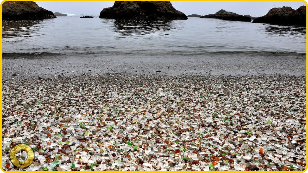
Glass Beach, located in Fort Bragg, California, was created by the people of the city. The area used to be a landfill used to dump waste materials such as glass, appliances, and various other items.
The area was closed to the public in 1967. In 1972, the area was re-opened, as a public beach. However, the beach is now covered with glass pebbles, which washed out of the dump and have been smoothed by the waves.
16. Whitehaven Beach, Australia
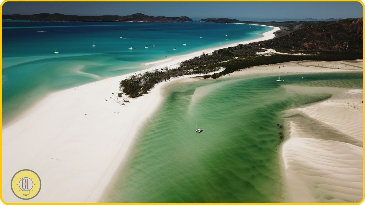
Whitehaven Beach is located on Whitsunday Island in the Whitsunday Islands of Queensland, Australia. The beach is composed of silica sands, which were created by quartz sands, which have been weathered by water and tropical sun.
The beach was added to the Queensland Heritage Register in 1999. Whitehaven Beach was also named the “World’s Best White Sand Beach” in 2004. The beach is a tourist attraction and is the most popular tourist destination in the Whitsunday Islands.
17. The Great Blue Hole, Belize
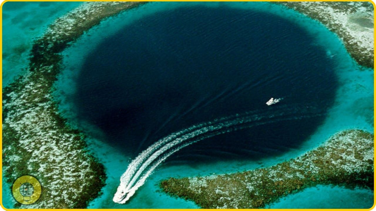
The Great Blue Hole is a large submarine sinkhole off the coast of Belize, which was formed during several episodes of quaternary glaciation when sea levels were much lower. The hole is circular in shape, over 300 meters across, and 124 meters deep.
The hole was discovered by Jacques Cousteau in 1971. The Great Blue Hole is listed as a World Heritage Site.
18. Cat Island, Japan

Cat Island is a small island located in the Inland Sea of Japan, just off the coast of Takaoka City in the Oshima subprefecture of the Hokuriku region. The island is home to a colony of cats. The cats were brought to the island to kill mice on the island.
However, they soon became feral and multiplied. Today, the island is home to about 150 cats, and they are one of the island’s main attractions. Cat Island is thought to be the origin of the Japanese Bobtail breed.
19. Bubble Island, Taiwan
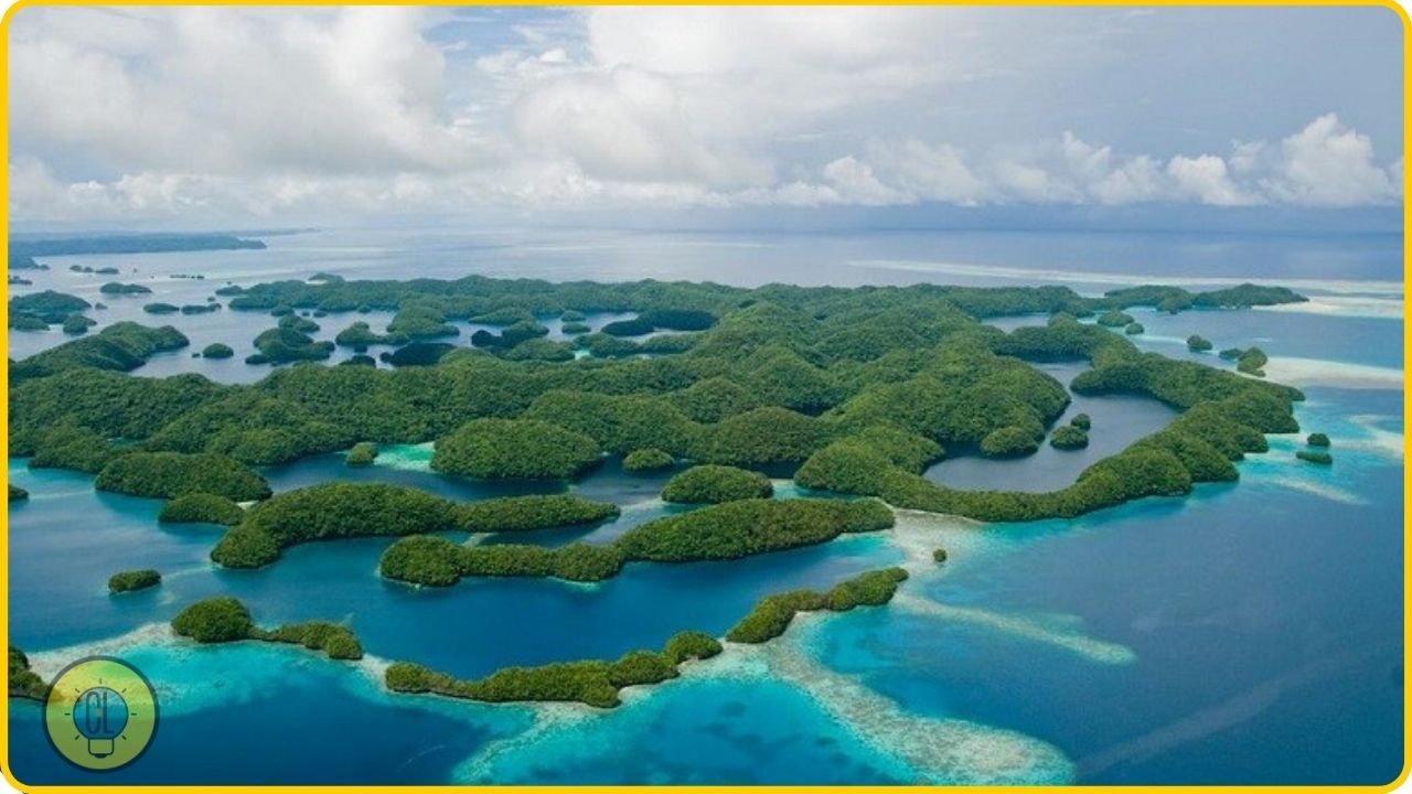
Bubble Island is an island in Taiwan, known for the natural phenomenon of bubbles. The bubbles are caused by methane gas rising from the seafloor.
The bubbles are trapped by the surrounding terrain and form a rainbow. The phenomenon can only be seen at low tide.
20. Stonehenge, England
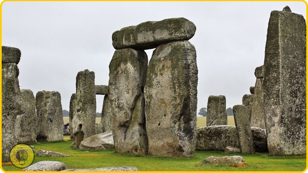
Stonehenge is a prehistoric monument located near Salisbury in Wiltshire, England. The structure consists of standing stones arranged in a circular setting and is a UNESCO World Heritage Site.
The stones were erected between 3000 BC and 2000 BC. The site and its surroundings were added to the UNESCO list in 1986. Stonehenge is managed by English Heritage and is open to the public.
21. Wave Rock, Australia
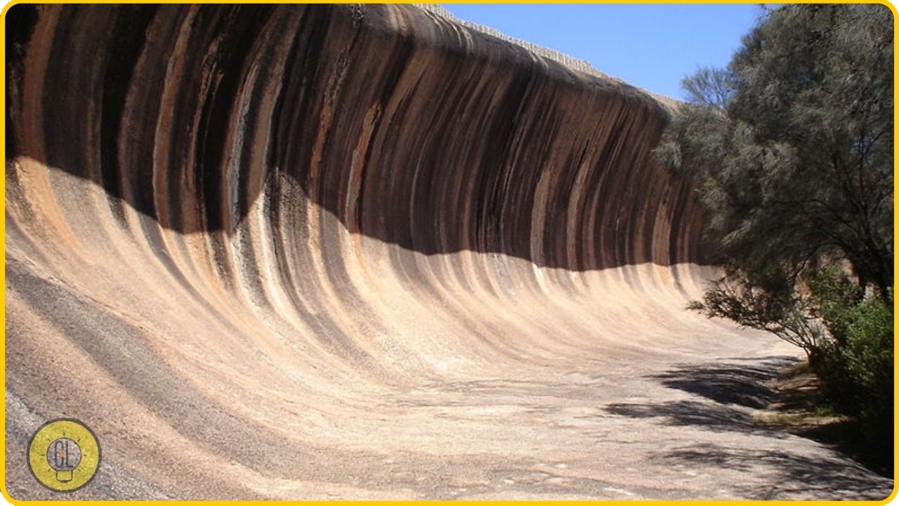
Wave Rock is a geological formation located in the Shire of Yilgarn, in the Hamersley Range of Western Australia. The formation was created by erosion and weathering.
The rocks are made of sandstone and look like waves. The formations are thought to be at least 290 million years old.
22. Naica Mine, Mexico
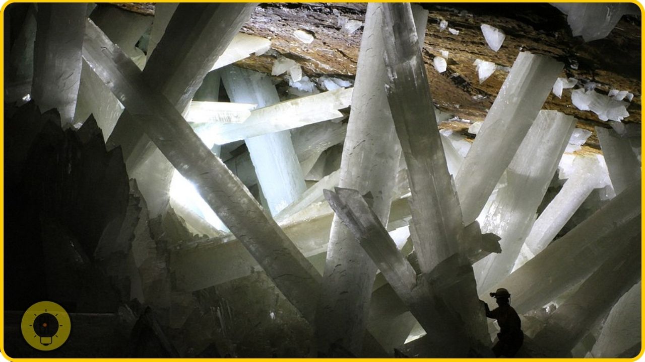
The Naica Mine is a former mining pit located in Naica, Chihuahua, Mexico. The mine is now a museum and contains the world’s largest crystals of the mineral gypsum.
The largest crystals are up to 36 feet (11 m) long, and weigh up to 55 tons. It is also the world’s largest crystal of selenite. The mine was added to the UNESCO World Heritage Tentative List in 2003.
